What surprises people the most about the Gobi Desert is that it is not all sand. The term desert conjures images of vast rolling dunes—and the Gobi certainly has these—yet this splendidly tranquil ecosystem covering more than half-a-million square miles contains fertile tracts as well. Perhaps more surprising still is that this arid landscape was covered in conifer forests and lush with lakes and streams about 80 million years ago.
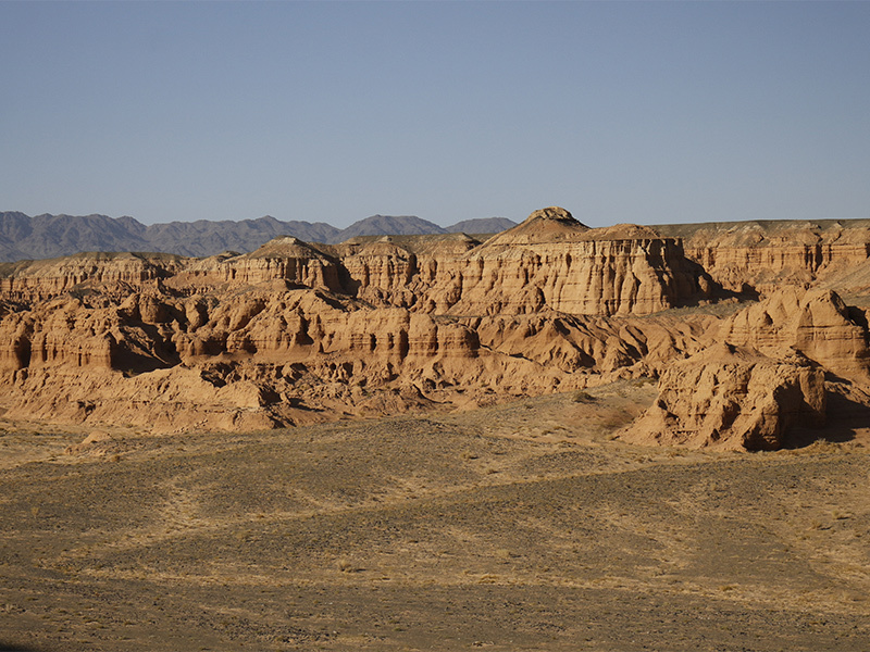
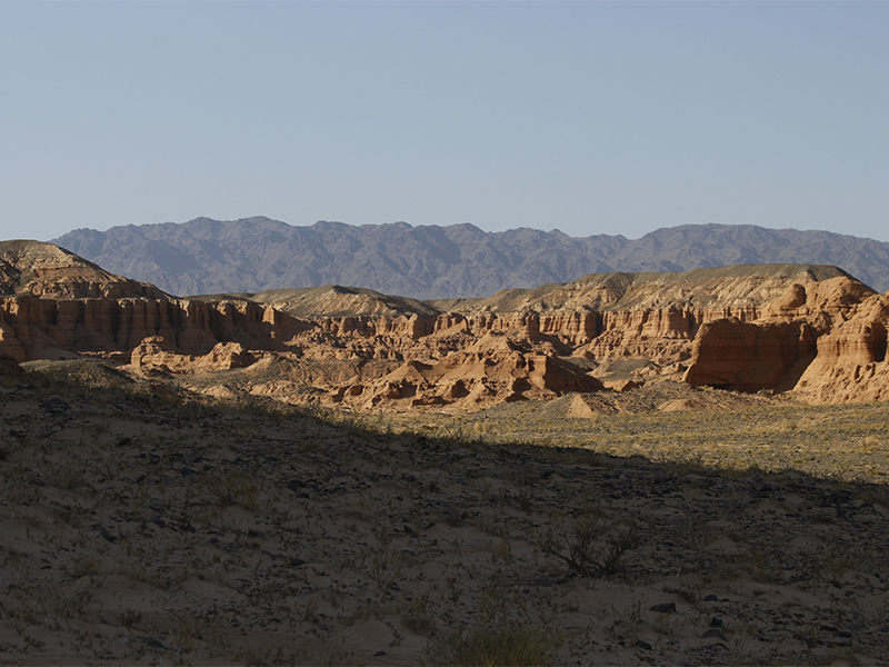
The Gobi, the fourth largest desert in the world, occupies territories of Mongolia and northern China, lying along a depression between the Altai and Khangai Mountains. And only 3% of its mass is covered with sand. The terrain is wonderfully varied as well, with formations of undulating dunes, deep ravines, panoramic plains, steep cliffs and narrow canyons. The mountains of the Gobi include the Gurvan Saikhan, Mt Noyon and Tost Uul.
Shaped by Water
Water plays a major role in the landscape, as heavy rain causes flash floods that erode surfaces, carving new formations and turning new pages on the geological book of this land—washing sediments from mountains into the plains. Water has also played a role through its relative absence. The world’s highest mountain chain, the Tibetan Plateau, blocks clouds from the Indian Ocean, preventing rain from reaching the Gobi.
Gobi Minerals
The Gobi is rich in natural resources, including the largest coal deposit in the world. The land also contains copper, gold, oil and even uranium. By force of dislocation of the Altai Mountains and volcanic activity, rock types here are rich and varied. The tectonic structures bear commercially exploitable deposits of iron, as well as rare metals such as mercury, gold, manganese, tungsten, and marble. Massive coal, copper and gold deposits are concentrated in the eastern part of Umnugobi Province, with oil and uranium in the southwestern region.
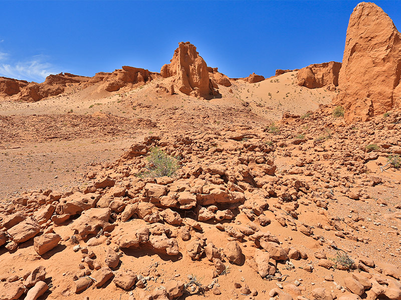
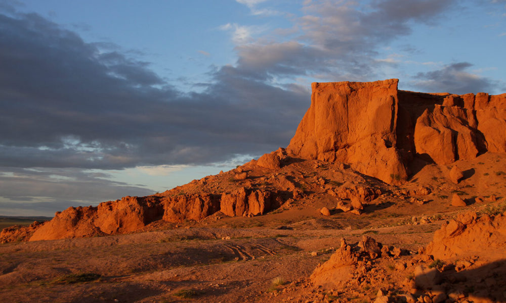
The Flaming Cliffs
The Gobi is composed of sediment from the erosion of volcanic rocks including granite and basalt, as well as from ocean sediments. These layers can be seen very well in the clay of the iconic Flaming Cliffs. Scientifically known as the Djadokhta formation, the Flaming Cliffs dates to the Cretaceous Period 84-75 million years ago. A must-see for visitors of the Gobi, it has preserved major archeological discoveries—including the first confirmed finding of dinosaur eggs.
The Flaming Cliffs tell the story of this land, presenting many strata of limestone of the Central Asian Orogenic Belt—one of the largest orogens in the world—dating some 800 million years to the early Triassic. The CAOB stretches from Ural Mountains to the Pacific Ocean, covering 3.3 square miles of area—approximately 11% of Asia’s surface area.
The Nemegt Formation
Dating from the Late Cretaceous, the Nemegt sedimentary geological formation consists of river channel sediments and contains fossils of fish, turtles, crocodilians, birds and the diverse fauna from the time of the dinosaurs. These shales and sandstones are remnants of ancient lakes, streams and evidence of floods. These deposits also preserve petrified woods, remnants of tall conifer trees, and sediments of this once rich habitat. The exact age of the Nemegt Formation is unknown but it is thought to be early Masstrichtian, 72.1 – 66 million years ago.